Türkiye
SILK ROADS IN ANATOLIA
Since the ancient times and due to its geographic location, Anatolia has been a bridge between the East and the West while also being one of the most important turning points of the Silk Road. During the Middle Ages, the Silk Road was stretching on multiple itineraries from Central Asia to Anatolia and then from Thrace to Europe. Furthermore, on the Aegean coast the ports of Ephesus and Miletus, in the Black Sea Region the ports of Trabzon and Sinop, in the Mediterranean the ports of Alanya and Antalya were used in order to reach Europe from sea.
The Silk Road in Anatolia; In the North: Trabzon, Gümüşhane, Erzurum, Sivas, Tokat, Amasya, Kastamonu, Adapazarı, Izmit, Istanbul and Edirne; In the South: Mardin, Diyarbakır, Adıyaman, Malatya, Kahramanmaraş, Kayseri, Nevşehir, Aksaray, Konya, Isparta, Denizli, Antalya are the centers passed by. Meanwhile, Erzurum, Malatya, Kayseri, Ankara, Bilecik, Bursa, İznik, İzmit, İstanbul was another used itinerary. In order to keep the commercial activities in Anatolia alive, Seljuks have taken measures to provide security by building caravanserais on these roads.
THE SILK ROADS AND THE REPRESENTATIVE LIST OF THE INTANGIBLE CULTURAL HERITAGE OF HUMANITY IN TÜRKIYE
Below are the elements inscribed in the Representative List, which are in close relation with the silk roads.
Arts of the Meddah, public storytellers (2008)
Meddahlık is an improvisational art of storytelling performed by the artists called meddah to illuminate, educate and entertain the public. Through the ages, it paved the way for similar narrative genres to flourish due to interaction among the peoples of Asia, the Caucasus and the Middle East within this wide geographical area. Meddahs perform in public places like caravanserais, coffeehouses, mosques and churches. The quality of the performance largely depends on the atmosphere created between the storyteller and the spectators, as well as the meddah’s ability to integrate imitations, jokes and improvisation often relating to contemporary events. This tradition, which places great value on the mastery of rhetoric, is highly regarded in Turkey. Arts of the Meddah, public storytellers was inscribed in 2008 (3.COM) on the Representative List of the Intangible Cultural Heritage of Humanity.
Mevlevi Sema ceremony (2008)
The Mevleviye are renowned for their whirling dervishes. Following a fast of long hours, the whirlers begin to rotate on their left feet in short twists, using the right foot to drive their bodies around the left foot. The eyes of the whirler can be open but is unfocused and the images are and flowing. At their ceremonies, Sema, a particular musical repertoire called ayin is played. Based on four sections of both vocal and instrumental compositions, it is performed by at least one singer, a flute-player, called neyzen, a kettledrummer and a cymbal player. Performers in the Sema receive 1,001 days of reclusive training within the mevlevi-houses (mevlevihane), where they learned about ethics, codes of behaviour and beliefs by practising prayer, religious music, poetry and dance. Mevlevi Sema ceremony was inscribed in 2008 (3.COM) on the Representative List of the Intangible Cultural Heritage of Humanity.
Âşıklık (minstrelsy) tradition (2009)
The Âşıklık (minstrelsy) tradition is performed by wandering folk poets and storytellers previously known as ozan, and following the spread of Islam as âşık. They are recognized by traditional folk stories as they tell during long winter nights in village rooms, konaks or city coffee-houses like Kerem ile Aslı, Âşık Garip, Köroğlu, Tahir ile Zühre. Today, the âşık often performs poetry types like atışma, koçaklama, güzelleme during festivals and feasts. The poems they recite, usually about love, are written in rhymed syllabic meter and end with a quatrain in which the âşık utters the Mâhlas, his pseudonym. Their improvisational performances may also include riddles, folk tales, verbal duels of wit and creativity with other âşıks, and verses sung while the minstrel holds a needle in his mouth to force him to recite poems avoiding B, P, V, M and F sounds. Because âşıks travel between communities, they help to spread cultural values and ideas to facilitate a robust social dialogue, in part through topical poetry and social and political satire. Âşıklık (minstrelsy) tradition was inscribed in 2009 (4.COM) on the Representative List of the Intangible Cultural Heritage of Humanity.
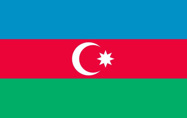
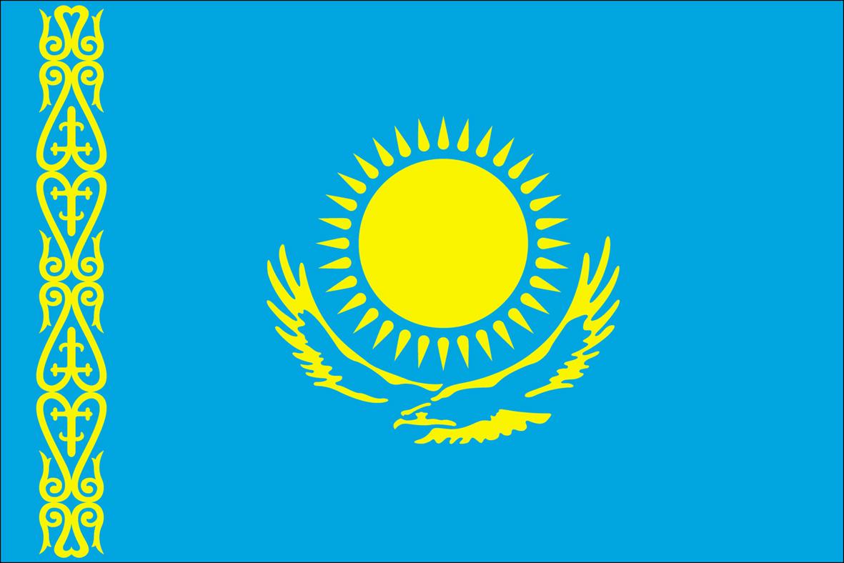
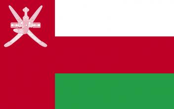
Nevruz (multinational file of Azerbaijan, India, Iran (Islamic Republic of), Kyrgyzstan, Pakistan, Türkiye, Uzbekistan, 2009)
Nevruz marks the New Year and the beginning of spring across a vast geographical area covering, inter alia, Azerbaijan, India, Iran, Kyrgyzstan, Pakistan, Turkey and Uzbekistan. Celebrated on 21 March every year, Nevruz is associated with various local traditions, numerous tales and legends. The rites that accompany the festivity vary from place to place, ranging from leaping over fires and streams to tightrope walking, leaving lit candles at house doors, traditional games such as horse racing or the traditional wrestling. Nevruz promotes the values of peace and solidarity between generations and within families, as well as reconciliation and neighbourliness, thus contributing to cultural diversity and friendship among peoples and various communities. Nevruz was inscribed in 2009 (4.COM) as a multinational file of Azerbaijan, India, Iran (Islamic Republic of), Kyrgyzstan, Pakistan, Turkey and Uzbekistan.
Turkish coffee culture and tradition (2013)
Turkish coffee has rich traditional culture, special preparation and brewing techniques. The beans are roasted in a traditional coffee pan, cooled in soğutaç, ground to a fine powder and cooked in copper pots (cezve). It is served in special cups, accompanied by a glass of water and lokum (Turkish delight). Coffee was the main beverage of kahvehanes (coffee houses) in the past where people meet to converse; share news about their daily lives; and read books. Turkish coffee tradition is considered as a symbol of hospitality, friendship, refinement and entertainment that permeates all walks of life. It also plays an important role on social occasions such as engagement ceremonies and holidays; its knowledge and rituals are transmitted informally by family members through observation and participation. The grounds left in the empty cup are often used to tell a person’s fortune. Having an important place in almost every field from literature to music, Turkish Coffee Tradition is an indispensable part of Turkish cultural heritage. It was inscribed in 2013 (8.COM) on the Representative List of the Intangible Cultural Heritage of Humanity.
Ebru, Turkish art of marbling (2014)
Ebru is the traditional Turkish art of creating colorful patterns by sprinkling and brushing color pigments onto a pan of oily water and then transferring the patterns to paper. Known as marbling, the designs and effects include flowers, foliage, ornamentation, latticework, mosques and moons, and are used for decoration in the traditional art of bookbinding. The practitioner uses natural methods to extract colors from natural pigments, which are then mixed with a few drops of ox-gall, a kind of natural acid, before sprinkling and brushing the colors onto a preparation of condensed liquid, where they float and form swirling patterns. Ebru artists, apprentices and practitioners consider their art to be an integral part of their traditional culture, identity and lifestyle. Their knowledge and skills, as well as the philosophy behind this art, are transmitted orally and through informal practical training within master-apprentice relationships. Achieving basic skills in Ebru takes at least two years. The tradition is practiced without barrier of age, gender or ethnicity, and plays a significant role in the empowerment of women and the improvement of community relationships. The collective art of Ebru encourages dialogue through friendly conversation, reinforces social ties and strengthens relations between individuals and communities. The number of women showing interest in the art of marbling has been increasing in recent years. Ebru, Turkish art of marbling was inscribed in 2014 (9.COM) on the Representative List of the Intangible Cultural Heritage of Humanity.
SILK ROADS AND THE WORLD HERITAGE IN TÜRKIYE
“Great Mosque and Hospital of Divriği”, “Historic Areas of Istanbul”, “City of Safranbolu”, “Selimiye Mosque and its Social Complex”, “Bursa and Cumalıkızık: the Birth of the Ottoman Empire” and “Diyarbakır Fortress and Hevsel Gardens Cultural Landscape” in the UNESCO World Heritage List are all located along the Silk Road routes in Turkey. The latter complex, as well as “Akdamar Church” in the Tentative List of Turkey, exemplify the outcome of cultural exchange along the Silk Roads in the form of unique architectural monuments produced by profound cultural synthesis.
Additional cultural property related to the Silk Roads on Turkey’s Tentative List include “Historic City of Ani” and “Iznik”, which mark the eastern and western borders of the Silk Roads along the Anatolian Peninsula; “Mardin Cultural Landscape”, “Konya-A Capital of Seljuk Civilization” and “Historic Guild Town of Mudurnu” among major urban settlements in-between; as well as “Seljuk Caravanserais on the route from Denizli to Dogubeyazit” over the land and “Alanya” and “Trading Posts and Fortifications on Genoese Trade Routes from the Mediterranean to the Black Sea” along the sea routes.
THE WORLD HERITAGE LIST
Below are the properties inscribed in the World Heritage List, which are in close relation with the Silk Roads.
Great Mosque and Hospital of Divriği (1985)
This region of Anatolia was conquered by the Turks at the beginning of the 11th century. In 1228–29 Emir Ahmet Shah founded a mosque, with its adjoining hospital, at Divrigi. The mosque has a single prayer room and is crowned by two cupolas. The highly sophisticated technique of vault construction, and a creative, exuberant type of decorative sculpture – particularly on the three doorways, in contrast to the unadorned walls of the interior – are the unique features of this masterpiece of Islamic architecture.
Historic Areas of Istanbul (1985)
With its strategic location on the Bosphorus peninsula between the Balkans and Anatolia, the Black Sea and the Mediterranean, Istanbul has been associated with major political, religious and artistic events for more than 2,000 years. Its masterpieces include the ancient Hippodrome of Constantine, the 6th-century Hagia Sophia and the 16th-century Süleymaniye Mosque, all now under threat from population pressure, industrial pollution and uncontrolled urbanization.
City of Safranbolu (1994)
From the 13th century to the advent of the railway in the early 20th century, Safranbolu was an important caravan station on the main East–West trade route. The Old Mosque, Old Bath and Süleyman Pasha Medrese were built in 1322. During its apogee in the 17th century, Safranbolu's architecture influenced urban development throughout much of the Ottoman Empire.
Selimiye Mosque and its Social Complex (2011)
The square Mosque with its single great dome and four slender minarets, dominates the skyline of the former Ottoman capital of Edirne. Sinan, the most famous of Ottoman architects in the 16th century, considered the complex, which includes madrasas (Islamic schools), a covered market, clock house, outer courtyard and library, to be his best work. The interior decoration using Iznik tiles from the peak period of their production testifies to an art form that remains unsurpassed in this material. The complex is considered to be the most harmonious expression ever achieved of the Ottoman külliye, a group of buildings constructed around a mosque and managed as a single institution.
Bursa and Cumalıkızık: the Birth of the Ottoman Empire (2014)
This property is a serial nomination of eight component sites in the City of Bursa and the nearby village of Cumalıkızık, in the southern Marmara region. The site illustrates the creation of an urban and rural system establishing the Ottoman Empire in the early 14th century. The property embodies the key functions of the social and economic organization of the new capital which evolved around a civic centre. These include commercial districts of khans, kulliyes (religious institutions) integrating mosques, religious schools, public baths and a kitchen for the poor, as well as the tomb of Orhan Ghazi, founder of the Ottoman dynasty. One component outside the historic centre of Bursa is the village of Cumalıkızık, the only rural village of this system to show the provision of hinterland support for the capital.
THE TENTATIVE LIST
Below are the properties inscribed in the Tentative List, which are in close relation with the silk roads.
Alanya (2000)
Alanya situated in the eastern part of the Gulf of Antalya is 137 kms away from Antalya by the main highway. The peninsula of Alanya surrounded by city walls was named "Karakesion" during the Hellenistic period went under the hegomany of Romans and Byzantines, followed by the Seljuks. The present name of the town comes from Alaaddin Keykubat, who did great service to the development of the town. Inside the Alanya castle there exist a Seljuk cistern, a Byzantine church, the Keykubat Sultan Palace and the ruins of a Seljuk bath, completed with the traditional urban texture. The castle extends down to the sea and encloses a medieval dockyard that is guarded by a 33 meter high octagonal tower of red stone and brick.
Seljuk Caravanserais on the route from Denizli to Dogubeyazit (2000)
The caravanserais, a new architectural type with social function developed in central Asia by the Karakhanids and Ghaznavids passed into Anatolian Turkish architecture. The institution of caravanserais has its most variations in Seljuk Anatolia, using the forms of Anatolian stone architecture. These buildings offering travellers in mountain and desert all the possibilities and comforts of civilization of the period each effectively a social foundation subject to an organized and continuous state programme, appear to present a typical characteristic of Turkish society, Denizli-Dogubeyazlt Route consists of about 40 Hans about which 10 are very well preserved. Some of these are Akhan, Ertokus Han, Saadettin Han, Obruk Han, Agzikarahan, Sultan Han (2), Oresin Han, Sikre Han, Mamahatun Caravenseria and Hacibekir Han.
Caravanserais were havens in which caravans could take shelter. They have their origins in the nomadic lifestyles of the Turkish tribes of Central Asia. At a very early period there existed a social institution called muyanlık, a word that means "charity", "pious deed", and "kindness." These were generally simple dormitories that offered travelers food and a place to sleep. By the 7th century, these simple dormitories had developed into more complex establishments called ribat, a word that may be translated as "inn." There is evidence that hundreds of these ribats were built. The culmination of this line of development is the massive caravanserais that the Seljuks built in Anatolia. Caravanserais were huge accommodations, facilities that provided shelter, food and drink for a caravan's full complement of people, animals, and cargo and could also handle its needs for maintenance, treatment, and care. They were arranged along trade routes at intervals that were calculated in view of the amount of distance that a caravan could be expected to cover in a single day. This distance was called menzil in Turkish, a word that means, among other things, "journey" in its archaic sense of "a day's travel". On the basis of the examples remaining and other evidence, this menzil seems to have averaged about 30 kilometer the equivalent, under normal conditions, of a six-hour journey to which another two hours had to be added for arduous travel in regions like deserts. Caravanserais or their simpler cousins, khans, were always located to that a caravan could be sure of reaching one by the day's end. Architecture and function Architecture is always determined by climatic and environmental conditions but never more so than in the case of caravanserais, to which the problem of security had to be added. Caravanserais in the eastern part of Anatolia for example were built like small, square castles heavily fortified with thick walls of stone. as we move westward on the other hand, they tend to be U-shaped and built of masonry and even, on occasion, of mud brick, Other differences are also apparent in such details s the sizes of individual rooms, the width of doors and windows, and the units and functional divisions they contained. Nevertheless there were certain things that every caravanserai had to have. There were certain to be baths, a masjid, a cistern o fountain, an infirmary, a cookshop, a place for the storage of provisions, and shops. Among the personnel there would certainly be a wainman, a blacksmith, a money-changer, a tailor, a cobbler, a physician, a veterinary, and so on. About 250 Anatolian caravanserais are known. Of these, eight are called sultanhan (literally "sultanis khan") and were all built in the 13 th century. Those constructed in the early part of the century generally conford to a standard plan of a courtyard and enclosed arens covering the same amount of ground. Seven of these building bean identifying inscriptions and one does not. Some of them are still referred to by the name sultanhan who others acquired local names to distinguish them. Agzikara Han is probably one of the most important "ordinary" khans and the degree of its workmanship approaches that of the royal khans. It is another of those caravanserais whose massive portal and rowers give it the appearance of a fortified castle. The double portal, free-standing masjid and domed hall, as well as the quality of its architecture, are all worthy of a true royal khan. The main portal is decorated with geometric patterns. Between the surmounting muqarnas and framing arches is a band of swastikas. The building was completed in 1237. Sultan Han On the Kayseri-Sivas road is another caravanserai with the name Sultan Han. Covering 3,900 square meters, it is the second-largest of the buildings of the group. All the distinguishing features of the Konya-Aksaray caravanserai are repeated here. The massive walls and supporting turret-towers give the building the appearance of a fortress.
Konya-A capital of Seljuk Civilization (2000)
Konya a cradle of many civilizations, became a center of culture and politics during the period of Seljuks. During the 12th and 13th centuries the city acted as the capital of Seljuks and many public buildings, examples of Seljukian stone carving were built at that time. Seljuks created a unique artistic world with cultural links reaching out from the Anatolian heartland to central Asia, the Middle East and the shores of the Mediterrannean and Konya is the significant example of this world. The outer fortress of Konya and the Alaaddin Mosque, the Sirçali Madrasa, many small mosques and tombs are examples of Seljukian architectural elements of Konya.
Mardin Cultural Landscape (2000)
Mardin is a city in a rocky region in southeastern Anatolia. The city is mainly medieval in origin and is situated on the slopes of a rocky hill, crowned by o fortress built on its citadel. This barren stoney region around Diyarbaklr and Mardin stretches as for as Sanliurfa and Gaziantep. The city as a whole with its traditional stone, religious and vernacular architecture and its terraced urban pattern is the best preserved example of Anatolian soil. Deyrulzafaran Monastery is one of the living religious center of Syriandacobites in Mardin, an impressive architectural complex in the Mesopotamian plain.
Historic City of Ani (2012)
The city of Ani, located on the high East Anatolian plateau, about forty two kilometers East of the city of Kars, was one of the most impressive settlements of the Medieval Period. The ruins of Ani occupy an approximately triangular site between the Arpaçay river which forms the border between Turkey and Armenia and one of its small branches called Alaca or Ani stream.
Although there is little information regarding the foundation of the city of Ani, the region was settled during the Urartian periods in the first half of the first millennium BC. After successive disputes between the Greco-Romans and Parthian-Sassanian states of Persia, the region of Ani was captured by the Kamsarankan Dynasty who built a citadel and a palace there in the fifth century AD.
Ani was conquered by the Arabs in the middle of the seventh century. After the battle between Arabs and the Kamsarakans, Ani was handed over to another Armenian dynasty: the Bagratides, who consolidated its power by uniting feudal principalities at the end of the ninth century. Although Bagratid King Ašot I (884-890) established his capital at Kars, King Ašot III (953-977) transferred the court from Kars to Ani in 961. It was during this period, (963-964) the inner walls of the city were constructed. With its new status, the city was enlarged and transformed from a fortress into a royal residence and capital of a kingdom. The king Smbat II (977-990) built the second line of the fortifications. During the reign of King Gagik I (990-1020), the city experienced a paramount prosperity for being the center of the cultural, religious and economic activity. It was during this period the renowned architect Trdat built the Cathedral of Ani and round church mausoleum of St. Gregory of Gagik I.
Following Gagik’s rule, the city was attacked by Georgians, Arabs and Byzantines. The town fell in 1045 to the Byzantines who reinforced the Citadel. In 1064 the city was conquered by Seljuks under the command of Alp Arslan. The impressive mosque of Manucehr which is the first mosque of the Anatolian plateau and the building known as Seljuk Palace located north of the city walls were built in this period.
During the 12th and 13th centuries Ani changed hands several times. After the Mongol invasion in 1239, Ani lost its importance as a commercial center. In the following years, the area remained in the realm of Karakoyunlus, Akkoyunlus and the Ottomans.
Within the city walls, the citadel of Ani is the oldest and most prominent structure which is located on a small hill close a point where the two river beds meet. The small church with its quatrefoil cross plan dating back to 10th century is probably the earliest centrally planned church in the region.
Due to hosting so many churches, Ani gained the traditional title of “the city of one thousand and one churches”. Many of the partially standing churches of Ani are centrally planned, even though various kinds of plans including cruciform, hexagonal and octagonal ones reflect the amazing variety of church plans. Most of these churches such as the Holy Apostles, St. Savoir, and the Church of the Shepherd, were built between the twelfth and thirteen centuries.
The Cathedral of Ani is one of the most important buildings in the site. Commissioned by the Armenian King Smbat Bagratuni II in 989, it was completed by his successor’s wife, Queen Katranidē by 1001. Its architect, Trdat, also participated in repairing the dome of Hagia Sophia in Constantinople.
There are also a great amount of dwellings and other civic buildings such as public baths, stores, aqueducts, bridges and roads as Ani was one of the unique medieval cities densely populated.
Trading Posts and Fortifications on Genoese Trade Routes from the Mediterranean to the Black Sea (2013)
Yoros Fortress 41°10'49.41" N - 29°05'46.89" E
Galata Tower 41°01'35.85" N - 28°58'26.88" E
Foça Fortress 38°40'09.25" N - 26°45'02.78" E
Çandarlı Fortress 38°56'01.69" N - 26°56'01.50" E
Amasra Fortress 41°45'02.84" N - 32°23'03.83" E
Akçakoca Fortress 41°05'10.80" N - 31°05'32.38" E
Sinop Fortress 42°01'42.52" N - 35°08'47.31" E
In the middle of 13th century, Genoeses were actively trading all over Mediterranean and Black Sea. Genoeses were originally inhabitant of Genoa, the city and Mediterranean seaport in north-western Italy. It was the capital of Genoa Province and of Liguria region.
In the eastern Mediterranean, Genoeses was greatly advanced by the Treaty of Nymphaeum (1261) with the Byzantine emperor Michael VIII Palaeologus, in exchange for the aid to the Byzantine reconquest of Constantinople, actually ousted the Venetians from the straits leading to the Black Sea.
As general Genoeses had possessions from 11th century to 19th century for nearly eight centuries over Mediterranean and Black Sea. Their main hub in Anatolia was Galata (Pera) in İstanbul.
"Trading Posts and Fortifications on Genoese Trade Route from the Mediterranean to the Black Sea" comprise some of the noticable trading ports situated in areas where the Genoese influence is still be observed. The property consists of five forts (Yoros, Foça, Çandarlı, Amasra, Akçakoca, Sinop) and one tower (Galata).
Yoros Fortress
As the main passage between the Black Sea and the Mediterranean, the Bosporus strait had a great commercial and strategic importance during the past. For this reason, numerous castles and fortresses were built on its shores. The fortress of Yoros is one of the most conspicuous of them. It was constructed on a hill at Anadolu Kavağı, on the Asian side of Bosphorus, on the Black Sea entrance.
The first mention of the place is made by the ancient historian Herodotus who describes it as the worship place of Jason and the Argonauts on the road for Cholchis. What is more, many Greek and Roman historical sources describe this place as ‘Hieron’, the Sacred Place. A great temple including altar of the twelve Gods or Zeus Ourios (‘of good winds’) served as a common haven and place of worship for sailors entering or leaving from there in antiquity. Hieron was the gate to the Black Sea. Additionally, it acted as a spot from which all Black Sea navigational charts took their measurements and the crucial shelter from the numerous dangers involved in negotiating the winding Bosporus: pirates, storms, and wind of the straits.
During the early Byzantine epoch, the emperor Justinian (527-565) charged a custom with a tax collector in the fortress. In addition, in the course of the Middle Byzantine period, the place was fortified with a larger wall enclosure and served to control from the north.
Byzantines, Genoese and Ottomans fought over its strategic position of the fort. After a naval battle in 1352, a Genoese military and commercial garrison was settled in the Yoros fortress, to handle the passage of the commercial ships and prevent the attacks to the capital city. Approximately half a century of Genoese occupation gave to it the epithet of ‘The Genoese Fortress’.
By the end of the 14th century the fortress was in the hand of the Ottomans and was used as a base for the construction of the Anadolu Hisar, one of the important headquarters of the Sultan Mehmed for the Conquest of the Byzantine capital in 1453. After this date, the Genoese was not allowed to use the fortress, which became an important garrison place of the Ottoman army for the defense of Istanbul. It was restored many times during the 15th and 17th centuries. During the reign of the Sultan Beyazıd II (1481-1512) a mosque, a bath and many houses were added for the families of the soldiers. Many western travellers and Turkish geographers mentioned Yoros and emphasized its strategic importance.
Today, a large fortress with an upper citadel surrounded by towers, a monumental entrance, many marble decoration and remain of buildings -discovered with archaeological excavations- dominates the little village of Anadolu Kavağı.
Galata Tower
The coastal band of Istanbul lying from the northern shores of Golden Horn to Tophane and the slopes behind it is known today as Galata district (or Pera or Sykai). Although there was an important settlement area during the Antiquity, the region gained importance during the reign of Constantine I (324-337). There was a fortified settlement composed of a harbour, a forum, a church, a theatre, bath buildings and houses. The present fortification walls were constructed by Emperor Justinian in 528. The 2 meter wide land walls surrounded by a 15 meter deep moat were enclosing an area of 37 hectares.
Owing to favourable topographical conditions, the territory acquired a commercial harbour function among the Italian trading colonies. Beginning with the Amalfitans, then the Venetians and later the Pisans obtained special privileges from the Byzantines in Galata. The Genoese were forced to move from Galata when the Venetians seized their territory during the Latin invasion in 1204. Hence, the Genoese established colonies on the southern shores of Golden Horn during the reign of Manuel Comnenos I (1143-1186). Even after the end of the Latin domination, in 1261, the commerce of the Byzantine capital was still in the hands of Venetians and the Geneose merchants. Emperor Michael Palaiologos VIII (1261-1282), who was able to recapture Constantinople from the Latins, signed the Nymphaion Treaty with the Genoese and permitted them to rebuild their commercial settlements. Thus, the Genoese designed and built the tower of Galata not only as an observation and a depository tower but also as a hallmark of the city which revealed the spirit of it. It was called the “Tower of Christ” by the Genoese and “The Great Tower” by the Byzantines. The tower presents a cylindrical shape (the height of the tower is 62.59 meters non-including the ornament on top, the outer diameter is 16.45 meters, the inner diameter is 8.95 meters, and the wall thickness is 3.75 meters) with its conical cap and rises high above all other buildings on the east side of the Golden Horn and provides a magnificent view of the open sea beyond the hills and the buildings of Istanbul. Hence, the Genoese would early distinguish between their own ships from those of hostile fleets.
Following the conquest of Istanbul, the Sultan Mehmet II signed an agreement with the Genoese and recognized their privileges which had been obtained during the Byzantine Empire. The Genoese colony strengthened their position in the 14th and in the 15th centuries when the district of Galata and its tower preserved its importance and its key role.
Foça Fortress
Having two natural harbours, Foça is a town which is located on a low hill projecting into the sea in İzmir Province, on the Aegean coast. It was one of the most important centers among the twelve Ionian cities and hosted Persian, Macedonian, Genovian and Ottoman civilizations.
Foça's harbour was much inferior in importance of Pera owing to the fact that transit trade here was negligible and the Genoese stronghold, which existed in this town in 1261, had a rather strategic importance. In 1275, the Byzantine Emperor Michael VIII Palaeologus granted the Genoese brothers Benedetto I Zaccaria and Manuele Zaccaria the town of Old Phocaea. There were huge deposits of alum nearby the region and the Byzantine emperor provided the Zaccarias with a monopoly on its export. Thus, Phocaea has become a large base of Genoa and became an export-import harbor in the commerce taking place between Aegean area and Anatolia. Additionally, during this time the Genoese also had colonies at Pera opposite Constantinople, and Caffa in the Black Sea, among others.
Genoese dominance in the Aegean was enhanced after a victory over a great maritime rival Venice at Curzola in 1299 and it could be said that by 1300 the Commune of Genoa was at its prime. It is important to understand that unlike the Venetians, the Genoese in the Aegean and Mediterranean often acted independently of the Commune. In other words, the colonies were usually governed with limited interference from the administration of the homeland and the ships used by Genoese sailors and merchants were often constructed and owned by private individuals. Because the Genoese often acted alone, it is far harder to establish a definitive Genoese ‘policy’ towards events in the Aegean.
Foça Fortresswas built in a strategic point securing the protection of the city in the 11th or 12th centuries. Genoese took over this fortress from the Byzantines and reconstructed it. When Phocaea was captured by the Ottomans in 1455, its ramparts were repaired and towers were added. An inscription at the entrance mentions that the repairs were carried out in 1538 - 1539 by Silahtar Iskender Aga, woodsman of the Sultan Mustafa Han who was the son of Suleyman the Magnificent. The castle also had a boat house which is used as an open air theater today.
Çandarlı Fortress
Çandarlı is a coastal town within the district of Dikili in İzmir The area that the Çandarlı Fortress locates in was settled from the archaic period but exact construction date of the fortress is not certain. In the 13th and 14th centuries, when the Genoese perpetuated Foça, they controlled Çandarlı and used this port for trading. Being a secure trade port, the effectiveness of Genoese increased from here. The fortress was restored by the Genoese and it should be noted that the “Genoese” attribution was very high. Today, in the form of a rectangle, with five towers, gutters, doors and walls, the fortress is quite well preserved.
Amasra Fortress
Amasra is located within the boundaries of the Province of Bartın. After the 4th Crusade in 1204, as a reward for their help, the Byzantine Empire was given the privilege of trading with Genoeses in the Black Sea. Thanks to this, Genoeses founded colonies in Kaffa (Today in Ukraine) and in Amasra in Anatolia. After this period Genoese kept going, founding colonies and trading in Black Sea. Amasra Fortress originally was built by the Romans but later it was restored by Byzantines, Genoeses and Ottomans. Especially in the 14th and 15th century several gates were built and a castle was fortified by Genoeses. Amasra Fortress is composed of two main parts named “Sormagir Castle” and “Zindan Castle”. Sormagir Castle is linked to Amasra by a bridge named “Kemere”. “Büyükliman Gate” stands on the northeast side of Amasra Fortress. While on the west side of the Fortress “Küçükliman Gate”, “Zindan Gate” exists on the south part. Walls of Amasra Fortress, lies in the northeast-southeast direction, 65 meters long. The south wall is 300 meters long and over this wall stands eight towers. “Genoese Chateau” takes place in the citadel of Amasra Fortress. Genoese coat of arms is accepted as conclusive evidence showing that this building was built by the Genoeses. Among these coats of arms, Duke of Milan Visconti’s serpentine shaped coat of arm and premier Italian families and cities emblems can be seen. After Byzantine Empire lost its control over this area, Genoeses maintained their supremacy for nearly two century until 1460.
Sinop Fortress
Thanks to its geographical position, Sinop was an important port in Black Sea during the history. It is believed Sinop Fortress was built in 8th century B.C. by the Miletus immigrant colonies. The fortress has been improved and developed by the Genoeses. The total bastion and wall length are approximately 2.000 meters. Bastions have eight meters width and 25 meters height. During the reign of Candaroğulları Sultanate, in 1345 Adil Beg permitted to Venetians and Genoeses to found colonies in Sinop. On Laurentiana Map dated 1351, can be seen a Genoese flag on Sinop city can be seen and this shows a Genoese colony existed in Sinop in that period. After Adil Beg died, Genoeses continued to use Sinop as a trade colony. Sinop served as an important station on the main trade routes during 13th and 14th centuries. Merchants, comes from Syria and Egypt stopped off in Sinop. After 1261, Genoeses and Venetians began to be active in trading in Black Sea region. Hereafter, trading with Europe became more intense and similar to other northern seaports, Sinop became more important. Genoeses brought to Sinop Florence fabrics, soap, glass and gem Stones. Correspondingly they bought copper from Sinop. Transit goods passed through Sinop were grain, alum, bee wax and leather. Sinop has strong relationship with northern harbours, especially with Kaffa harbour. There was a Genoese harbour in the region named “Kayzer Koltuğu”. Behind the harbour there was high tower. Genoeses were loading copper which mined near Sinop and they were loading out goods they brought. This harbour was so beautiful that depicted by several painters.
Akçakoca Fortress
Akçakoca Fortress takes place near the Akçakoca city within the boundaries of province of Düzce. Akçakoca Fortress was built on a cliff 100 meters height. On the west wall of fortress exists semicircle eaves. A bastion is located on the south wall and there is a cistern in the courtyard. Walls of fortress was built by ruble stone and brick. The Genoeses put their coat of arms on the wall of Yoros Fortress in İstanbul and Amasra Fortress to indicate their adding to building. Results of some chemical analyses on brick and plaster used in Akçakoca Fortress, show it was built in the same period as the Yoros Fortress and the Amasra Fortress. This result supports the idea that this building was used by the Genoeses.
İznik (2014)
Known as Nicaea since ancient times, İznik is located on eastern shore of Lake İznik (Askania Limne) surrounded by ranges of hills within the Bithynia (Marmara) region of Anatolia. There has been human settlement on İznik since prehistory, as witnessed by discoveries of several mounds and tumuli around. According to geographer Strabo, the ancient town was founded in 316 BC by Antigonos, the commanders of Alexander the Great (356-323 B.C). It is also reported that Lysimachos, another general of Alexander, took the city and renamed it after his wife Nicaea. It was during this Hellenistic period that the settlement was planned as a rectangular city with its four gates and two major roads intersecting at the centre.
İznik enjoyed a period of expansion and prosperity under Roman rule. The first phase of today’s city walls was built in the late Roman period probably against the attacks Goths began in 258 AD. The four monumental entrance gates of the city, which were called Lefke (east), İstanbul (north), Göl (west) and Yenisehir (south) were built by the Roman Emperors Vespasianus and his son Titus. The other buildings dated to the Roman period are the theatre located on the southern west part of the city and the Obelisk of Gaius Cassius Philiscus erected on the road from İznik to İzmit (Nicomedia).
During the Byzantine period, İznik became an important religious centre, particularly after the Emperor Constantine was converted into Christianity in 313 AD. The first Christian Council called the great Council of Nicaea was held in İznik in 325 AD with the participation of bishops more than three hundreds came from different parts of the empire. The Seventh Ecumenical Council was also convened in Nicaea in 787 to deal with the iconoclastic controversy on the use of icons. This council was held in the church of Hagia Sophia, constructed by the Emperor Justinian over the ruins of the former church dating back to the 4th century. As it was demolished after an earthquake in the 11th century, the church was rebuilt as a basilica with three naves. The church is still located at the point where the roads leading to the four main gates in the district centre meet. A hypogeum, an underground grave found in the rural part of the town is one of the oldest Christian structures in İznik built in the 4th or 5th centuries AD. Covered by a vault and decorated its ceiling and with colourful frescoes, it is one of the rare examples of the period of early Christianity. Built as a part of the Hyakinthos Monastery in the 7th century, the Koimesis Church was also one of the most important early Byzantine architecture. The church was destroyed in the 1065 earthquake. Although it was repaired in later times, only some of its ruins have survived to the present. Böcek Ayasması (Baptistery), a round structure with a water spring at the center of a quadrangular fountain, is also erected as part of the Hyakinthos Monastery.
Anatolian Seljuks took over Nicaea in 1081, made the city their capital and renamed it İznik. The city was regained by the Byzantines in 1097. During this period, some other churches were built such as Hagios Tryphonos Church with a cross-shaped plan. After the Fourth Crusade captured Byzantine capital of Constantinople in 1204, İznik became the core of the successor Byzantine Empire after emperor Theodore Laskaris founded the Empire of Nicaea there. During this period, the city became an important political and cultural centre with the construction of imperial and civic buildings such as the palace of the Patriarch, the hospitals, the charity institutions, and the churches. The city walls were also expanded and reinforced with plenty of towers.
When Ottoman Beylik captured İznik in 1331, they also formed their capital here. Although İznik enjoyed this title for only short period, it was during this period that Ottomans built fine examples of early Ottoman architecture, such as the Haci Özbek Mosque (1333), the Green Mosque (1378–91) also known as the Yesil Cami, the Yakub Çelebi Mosque, Mahmud Çelebi Mosque, Nilüfer Hatun İmareti (Soup Kitchen) (1388) and the Süleyman Pasa Madrasa (mid-14th century). During this period, Ottomans also used existing buildings for their own purposes. For example, the Hagia Sophia Church was converted into mosque called Orhan Camii. During the reign of Sultan Süleyman the Magnificent, a minaret was erected and its walls were decorated by the famous architect Sinan.
With the growth of İstanbul as an Ottoman political and cultural centre after 1453, İznik lost its prosperity. The city was revived soon, however, with the introduction of faience pottery making. During the 16th and 17th centuries, İznik became famous for its beautiful tiles which decorate mosques and palaces throughout the Ottoman Empire. Archaeological excavations carried out in tile kiln sites for more than thirty years by the Istanbul University Department of History of Art has not only revealed the unique production and decoration techniques of İznik ceramic, but also shed some light on the social and economic development of the region. The tile kiln excavations at İznik are still going on today.
Historic Guild Town of Mudurnu (2015)
The settlement of Mudurnu was founded along a deep, narrow valley formed by the Mudurnu (Gallos) River, in a region rich with pine forests and thermal springs. The ancient geographer Strabon informs that the town of Modrene (Mudurnu) was located on the major trade routes of Anatolia. The Silk Road, which connected inner Asia with Tabriz in the 13th-14th centuries, continued to Bursa via Erzurum-Sivas, and passing through Mudurnu-Göynük-Taraklı-Geyve, finally reached Constantinople. Another major trade route of the time, the Crimean Road, connected Damascus and Mediterranean port cities with Bursa, proceeding to Constantinople and the Black Sea through Mudurnu-Bolu-Kastamonu-Cide. Situated at the junction of these roads, Mudurnu served as an important military base and mid-size trading town in the Byzantine, Seljukid and Ottoman periods.
Mudurnu has played a distinct role in three ‘periods of establishment’ that were milestones in the development of the Turkish states in Anatolia. The ‘First Period of Establishment’ is the beginning of the Turkification of Anatolia. Following in the footsteps of the Seljuks, the first Ottoman incursions to Mudurnu were made by Osman I. The town fully became Ottoman territory under Osman’s son Orhan in 1307, hence becoming a city of the Ottoman heartland. During Orhan’s reign, the foundations of the first regular Ottoman army and treasury systems were laid by Halil Hayrettin Paşa (Çandarlı), who was raised in the Ahi lodges of Mudurnu and taken by Orhan to the Court from the Madrassah of Sheikh Fahreddin-i Rumi. Halil later became the first Ottoman Grand Vizier, his Çandarlı lineage (1330-1450) helping to establish the Ottoman administrative and political system. Mudurnu and Göynük served as Early Ottoman centers for the education of crown princes. The ‘Second Period of Establishment’ was the Ottoman Interregnum (1402-1413), when the region of Mudurnu was a refuge for crown princes who fled Timur’s armies. Of these, Çelebi Mehmed set up his camp on the highlands of Mudurnu-Seben and oversaw the establishment of the second Ottoman Reign. The ‘Third Period of Establishment’ was the Turkish War of Independence (1919-22), leading to the establishment of the Turkish Republic. During the conflicts between the Sultan and the Atatürk’s new Ankara government, the most turbulent rebellions against the National Resistance were suppressed around Mudurnu. Since then, the community of Mudurnu has been among foremost supporters of Turkey’s Republican ideals.
A fundamental element from the outset of Mudurnu’s development as a Turkish settlement has been the Ahi Order (Akhism), a merchants’ solidarity organization and a guild system based on a philosopy of tolerance and fair distribution of wealth. The Ahi Order was established in the early 13th century by Ahi Evran in order to integrate Turkish manners and customs with the Muslim faith, to create employment opportunities for merchants and craftsmen that migrated from Asia to Anatolia and to make them capable of competing with their Byzantine counterparts; to maintain quality standards for their goods and products; to regulate the production according to needs; to infuse craftsmen with morality; to provide economic independence to Turkish people and to support those in need. The ethical values and organizational structure of the Ahi Order lie at the heart of contemporary tradesmen and craftsmen organizations. A derivative of the Arabic for ‘brother’, ‘Ahi’ means generous and hospitable. The Ahi Order combines material qualities like ‘skillfulness, productivity and professionalism’ with moral qualities like ‘maturity, selflessness and truthfulness’, educating people along these principles through a master- apprentice relationship. Beside commercial and social life, the Ahi Order has reflections in folklore, as Ahi practices like ‘throwing one’s shoe over the roof’ are idiomatic expressions today.
The earliest trace of the Ahi Order in Mudurnu is the mention, both in the Book of Aşık Paşazade and the Book of Neşri, of Sultan Orhan looking for the ‘Beştaş Ahi Lodge’, a ‘border zawiya’ left from Seljukid times. The famed 14c. traveller Ibn-i Battuta, who travelled around Anatolia in Sultan Orhan’s time, describes Mudurnu as a “town inhabited entirely by Muslim-Turkish people and full of Ahi zawiyas and lodges” and praises the hospitality of the locals. In the Early and Mid- Ottoman eras, Mudurnu emerges as an important centre of merchant-artisanship and trade based on the Ahi system, and its location on major trade routes. The wealth accumulated by the commercial production of the Ahi guilds was channelled into urban development, producing sophisticated commercial, religious and residential architecture. Many mansions, waqfs, khans and caravanserais were built to meet the needs of campaigning Ottoman armies, trading caravans, postal organizations and diplomatic couriers who used Mudurnu as a staging post and place of accommodation until the mid-19th century. One of the ‘poultry-providing counties’, Mudurnu had local products including butter, cheese, barley and pears directly sent for consumption in the Royal kitchen. Due to these close ties to the Ottoman Court, Mudurnu was nicknamed ‘Little İstanbul’. Particularly mentioned in written sources are the sought-after mirrors produced in the Mudurnu Mirror-makers Market, the ‘maiden needles’ produced by the needle workshops, the products of the Mudurnu Textile-Silk Factory, the hand embroideries, ironware, copperware, saddles, knives and goat hair products of Mudurnu. The Ottoman traveller Evliya Çelebi, who visited Mudurnu in 1650, describes the town as having “3000 houses, 17 neighbourhoods, Yıldırım Mosque and Madrassah, 1 quranic madrassah, 13 children’s schools, 3 khans and hammams and 1100 needle workshops. Needles and wooden pitchers made in Mudurnu are sent to the “Lands of Rum and to India”. The mid-17c. Ottoman scholar Kâtip Çelebi describes Mudurnu as “a kadiluk (judicial official’s jurisdiction) [with] 11 neighbourhoods, 2 hammams and 3 mosques. Beside Yıldırım Bayezıd, Sultan Suleiman and Asilbey Mosques, there is a Yıldırım Madrassah and Dibek Khan built by Rüstem Pasha. Most of its populace deals with needlemaking. There is a citadel on top of the eastern hill, surrounded by walls on three sides.”
The historical urban landscape of Mudurnu today presents a quiet but striking ensemble of monumental and civic architecture set on a rocky river valley. The distinct characteristics of traditional Mudurnu houses, similar to other Western Black Sea towns, include wood as predominant building material, a serene rhythm of windows, protruding upper level windows, angled corbelling adjusted to the streets and topography, hipped roofs, triangular pediments and wood-carved decorations on building facades. Some prominent examples are the Armutçular, Haytalar and Keyvanlar Mansions. As for prominent monuments, three ‘Sultan mosques’ were built in the 14th-16th centuries. in Mudurnu. Only foundations remain from the Imaret Mosque built by Sultan Orhan, but Yıldırım Bayezıd Mosque, significant in terms of Early Ottoman architecture, and Sultan Suleiman (the Magnificent) Mosque, built in the Classical Ottoman period, are still in use today. Bayezıd I, who had his crown prince education in Mudurnu, had his namesake mosque, hammam (1382) and madrassah built to become impressive buildings of their time. Other monuments include the Byzantine Citadel; approximately 30 saint tombs and graves which include those of Fahreddin-i Rumi and Şeyh-ül İmran; and the Clock Tower (1890). The historical Bazaar (Arasta) located in the city centre is formed by four parallel main streets and smaller perpendicular streets in grid layout. The shops lined along the streets, built for the crafts of making needles, knives, copperware, ironware and the like, exhibit Late Ottoman technical and stylistic properties; the late-19th/early-20th-century steel-beamed, double-storeyed shops represent important examples of their period. The most important intact feature of the shops is the mobile shutters, which open up to form canopies and down to form exhibit counters. As a whole, Mudurnu has preserved its typical Ottoman town character to a great degree.
Mudurnu’s wide range of intangible heritage values include the Ahi legacy, social gatherings (‘birikme’ and henna nights), holidays organized by the bazaar merchants, celebrations in honor of the saints Şeyh-ül İmran and Karaaslan, handmade embroideries, local cuisine, legends, dialects, folksongs, dances and village games. Foremos among these is the centuries-old Ahi culture still kept alive in Mudurnu. One of the many traditional practices within the Ahi culture is the Merchants’ Prayer or Prayer of Abundance (Esnaf Duası), performed before the main Friday prayer. Estimated to be dating back 700 years, the Merchants’ Prayer entails all of the town’s merchants coming out of their shops and standing in long lines to pray. After the weekly prayer, bread prepared to honor the dead is offered. The Prayer is performed both in the Middle Market and the Ironsmiths’ Market (two of the Arasta’s main streets). In the Middle Market, merchants who practice their craft sitting stand up to pray, while those who practice their craft standing up sit down to pray, a gesture of respect the craftsmen show for each other. Young craftsmen trained in the apprentice-master tradition go through the rite of passage through the ‘Belt Wrapping’ (‘Şed Kuşanma’) ceremony. In the 2009 ‘Ahi Baba’ contest organized by the Ministry of Industry and Trade and the Ministry of Culture and Tourism, 83-year-old ironsmith Mehmet Şankaya from Mudurnu was selected the Ahi of Turkey. The Ahi culture has a deep-rooted place within the social traditions of Mudurnu. The ‘Ahi Culture Week’ is celebrated across the country every year. For the first time in 1994, Mudurnu was included in the program of events as the first district (on a lower tier than a province) in Turkey. Although having lost its historical strength, the pre-industrial artisanal production and the specialized commercial street of the Classical Ottoman period still survive in Mudurnu. Among the three main commercial streets, Ankara Avenue has shoemakers and Belediye Avenue (Ironsmiths’ Market) has ironsmiths and tinmakers in the majority of shops. The merchants of the Arasta, with their various occupations, are members of the Confederation of Turkish Tradesmen and Craftsmen, the present-day heir of the Ahi Order.
Akdamar Church (2015)
Akdamar Church (the Church of the Holy Cross) is located on Akdamar Island in Lake Van within borders of Gevaş District of Province of Van. Situated in the region of Eastern Anatolia, Lake Van is the largest lake in Turkey. Akdamar Island, also known as Aghtamar, Akhtamar and Ahtamar, is the second largest of the four islands in Lake Van. It is about 700.000 m² in size and located about 3 km from the shoreline.
The Church was built between 915 and 921 AD by Architect Bishop Manuel, under the supervision of Gagik I Ardzruni, an Armenian King who reigned over the Kingdom of Vaspurakan as a vassal under the Abbasids. The first information about the construction of the church was given in the 10th century by Thomas Ardzruni, the chronicler of the deeds of King Gagik. The construction date is also confirmed by the inscription on the church's west façade and texts written in the late 18th century and early 19th century.
Akdamar Church has a four-lobed clover-like, cross-shaped plan which called “Hripsime Type” in reference to the Hripsime Church at Vagharshapat, built in 618 AD. The church was built of volcanic tufa, with an interior measuring 14.80 m x 11.5 m and the dome reaching 20.40 m above the ground. The central part, domed with a conical roof, has a square shape and is surrounded by four niches with semi-domes, one of which serves as the apse. Four additional niches with semi- circular plan at each corner, between the exedra serve to broaden the central domed main hall. The niches at the eastern end lead to a small rectangular cell on each side of the apse. The exedra and niches surrounding the main hall are reflected on the exterior in the form of polygonal walls.
The wall structure of the church is made of rectangular cut stones over a two-tiered base. In order to diminish the weight of the walls, smaller stones were used in the upper layers than those below. As a protective measure against earthquakes common in the area, stones of different size were used along the same row, insuring better bond. This technique is common in Armenian works. In addition, the colourful appearance due to the different shades of tufa stones prevents monotony in the façades.
The stone relief decoration of the church has an extraordinary place among well-known medieval art pieces. Bold reliefs surround the building in various bands and at different heights, sometimes erupting out of walls as sculpture, appearing at other times as bordures enhancing the architecture. They present a wide range of themes, ranging from religious subjects derived from the Bible and the Old Testament as well as earthly scenes such as palace life, hunting figures from daily life, floral and geometric figures and a variety of animals.
A significant depiction on the west façade displays King Gagik presenting a model of the church to Prophet Jesus. The Abbasid Caliph Muktadir is depicted in the middle of the east façade, in the grape vine relief, sitting cross-legged, wearing a crown and has a nimbus halo. Jonah thrown overboard, Mary with Baby Jesus, Adam and Eve's expulsion from heaven, David's fight with Goliath, Samson killing a Philistine, three young Jewish men and Daniel in the lions' den are other prominent figurative scenes from façades of the church.
The interior of Akdamar Church was decorated with frescoes, which are rare in Armenian Art. The frescos depict the Story of Creation and scenes from the life of Christ. Most of the frescoes are still distinguishable and some of them are well preserved, however, in some parts they are severely damaged. The well preserved frescoes might have been painted over at a later date.
From the date of construction, several buildings have been added to the Church and the building was repaired several times. According to an inscription located on the southern façade, during the period of Catholicos Stephanos III (1272-1296), the dome and the rooms on the eastern corner of the building were repaired. Also, Chapel of the Saint Stephanos was built as an independent structure on the southeastern side of the church. In the period of Catholicos Zacharias I (1296-1336), Saint Sergios Chapel was built adjacent to the northeast corner of the church. However, the construction date of the narthex (gavit) next to the west facade of this chapel is unknown. The large narthex (zhamatun), adjacent to the church's the western cross arm, was erected in 1763, during the period of Catholicos Thomas III, according to the inscription on the western entrance. Bell tower in front of the southern entrance of the church is dated to the beginning of the 19th century.
During the tumultuous history of the Catholicosate, the church centre was moved to different locations together with the political authority. When the Ardsruni and Bagratuni vied for political dominance and legitimacy, the Armenian Catholicosate moved from Dvin to Aghtamar in 927 and to Arghina in 947. In 1021, Senekerim-Hovhannes Ardsruni, king of Vaspurakan, surrendered his crown to Byzantium under pressure from Seljuk Turk incursions and resettles in Cappadocia with his royal household. In 1116, Catholicosate of Akdamar was established by Archbishop Davit as an independent episcopate of the Armenian Apostollic Church and kept its existence for almost eight centuries, until 1895. The church was abandoned during World War I.
In 2005-2006 the Turkish government carried out a rehabilitation project to preserve the historical identity of the Akdamar Church. In 2007, the church was opened to visitors as a monument museum. In 2010, the government decided to open the church for religious ceremonies once a year.
THE SILK ROADS AND THE MEMORY OF THE WORD REGISTER IN TÜRKIYE
Evliya Çelebi's "Book of Travels" in the Topkapı Palace Museum Library and the Süleymaniye Manuscript Library
Evliya Çelebi's Seyahatname or "Book of Travels" is the longest and fullest travel account in Islamic literature-perhaps in world literature. It is a vast panorama, both an extensive description of the Ottoman Empire and its hinterlands, and an account of the author's peregrinations over roughly forty years (1640-80). It provides an insight into Ottoman perceptions of the world, not only in obvious areas like geography, topography, administration, urban institutions, and social and economic systems, but also in such domains as religion, folklore, dream interpretation, and conceptions of self.
Documentary heritage submitted by Turkey and recommended for inclusion in the Memory of the World Register in 2013.